
For April’s Route of the Month, we’re going off-road a bit.
The idea behind these Routes of the Month are to build up a bit of a database for folks and to get out and explore the area. Eventually, it’ll be ok to ride these with friends, but for now we do what we can.
I’d love it if folks give the rides a try, take some photos and tag @dirtbag.cycles on Instagram (I’ll share them on my story) and try to get people out riding.

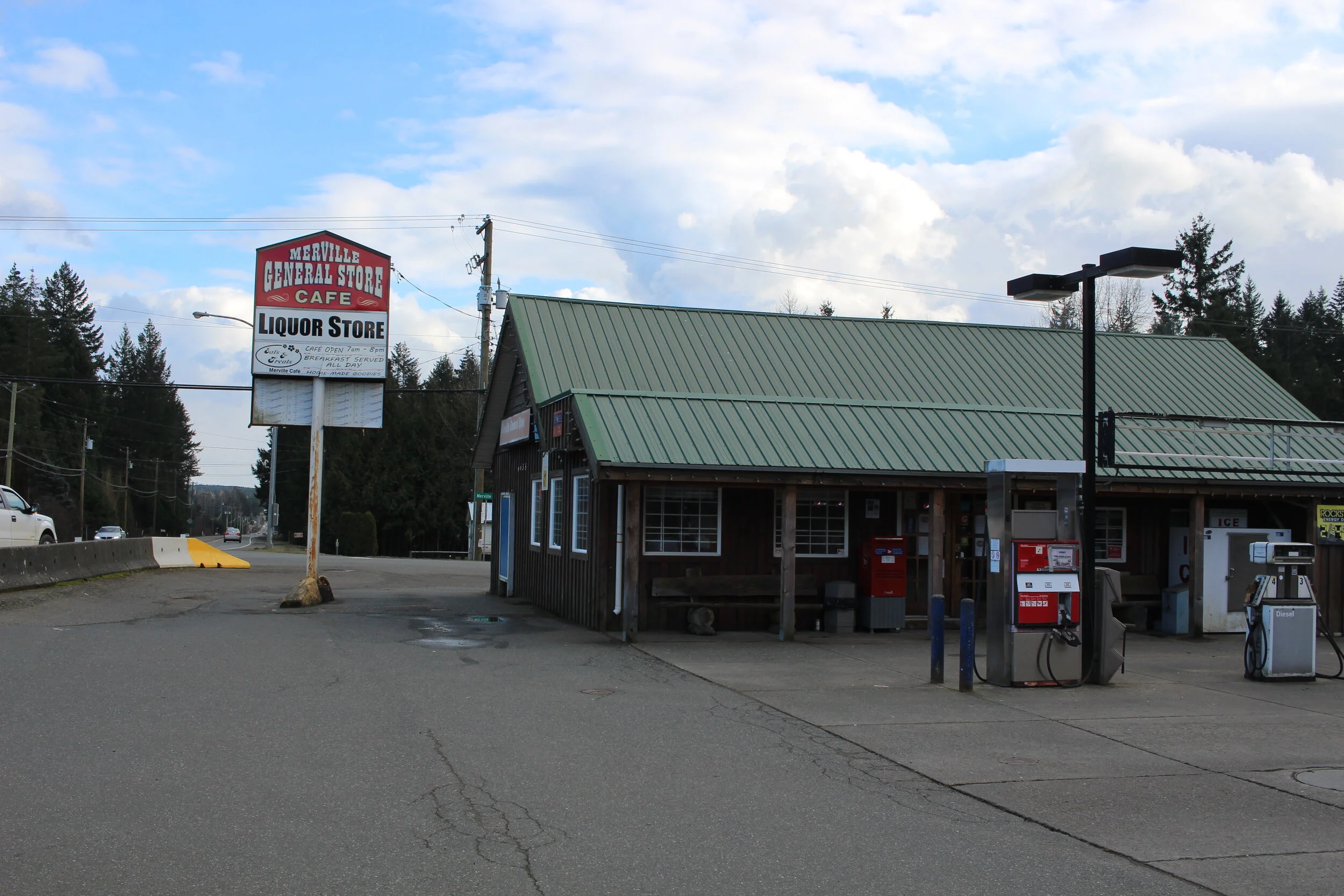
April’s ride is one I’ve done before trying to figure my way around the Comox Valley. The route starts at the Merville Store, which puts you right out in the rural areas with their sweet rolling hills and few cars. Head out to old Headquarters for the first bit of mixed-terrain. Take a picture of your bike by the Headquarters ruins for extra points. Across the road is another bit of trail, which will hook you on to Fitzgerald Road. Cross the little yellow bridge and carry on. The road will eventually end, but that’s not the end of the road for you. Up the hill into the woods is a pothole riddled fire road with excellent forest all around, which serves as a pretty neat shortcut if you want to avoid South Farnham. Or not. It’s up to you.
From here it’s horse country, Dove Creek road until Brazier, and then head right and go into the woods again. Head through the Wildwoods Interpretive Forest until you get to Piercy, and head up to the mountains. Across the highway keep going past Nymph Falls park and turn left at the airport (you’ll see it). From here take “Bear Bait” trail all the way until it ends. You should now be at Comox Lake. I’d recommend a snack now (and a swim if you wait until summer). Cross the bridge and take Comox Logging Road towards Courtenay. I know it’s a good speedy road, but keep your eyes peeled for the second graffiti area (and photo spot number two!).

From there keep on keepin’ on until Courtenay. Get into downtown, turn past the brewery — stop for a pint — and head onto the One Spot trail. Carry on until Todd Road, which is basically the end of the OS at this point. Back on to Dove Creek and take South Farnham this time (it’s downhill mostly) and head back into Merville. From here you should know the way to get back to Merville Store.
Feel free to jump on to the route at any point, and figure out your own fun bits. That’s the point!
As I’ve mapped it, the ride is 62.7 km, with 370 m of elevation. Komoot says it’ll take almost 5 hours with an average speed of 12.8 km/h. I have not done the ride yet, but I did a similar one back in May 2020 that took me 2.5 hours, my average was around 19 km/h. Who knows how long this’ll take, and there are plenty of bailouts along the way. You’ll probably be faster than what Komoot thinks. Or slower. It’s all up to you.
Let me know what you think of the ride, and post your photos to IG with the @dirtbag.cycles tag.
Dirtbag Cycles respectfully acknowledges that we are riding on the Unceded traditional territory of the K’òmoks First Nation, as well as the Coast Salish, We Wai Kum, We Wai Kai, Tla’amin and Homalco First Nations. We want to respectfully acknowledge these Indigenous peoples who have not ceded their lands under any treaty. Gila’kasla.